Hiking! Yes, Hiking! One of my favoritiest thing to do in New Zealand is none other than hiking! I love that feeling of getting to the summit for the surreal views that makes all that hard work from before worthwhile. With that, I’ll be sharing some of my favorite hiking tracks I did during my time in New Zealand in this article. May this information be useful for you in planning which track to take!
Hiking Tracks in South Island
1. Ben Lomond Track
Fitness required: High
Gradient: Steep (1,438 m elevation gain)
Distance: 11 km return via same track
Walking and tramping: 3-4 hr to Ben Lomond Saddle, 6-8 hr to Ben Lomond Summit
Highlights: Panoramic view of Queenstown, Lake Wakatipu and the surrouding mountain ranges.


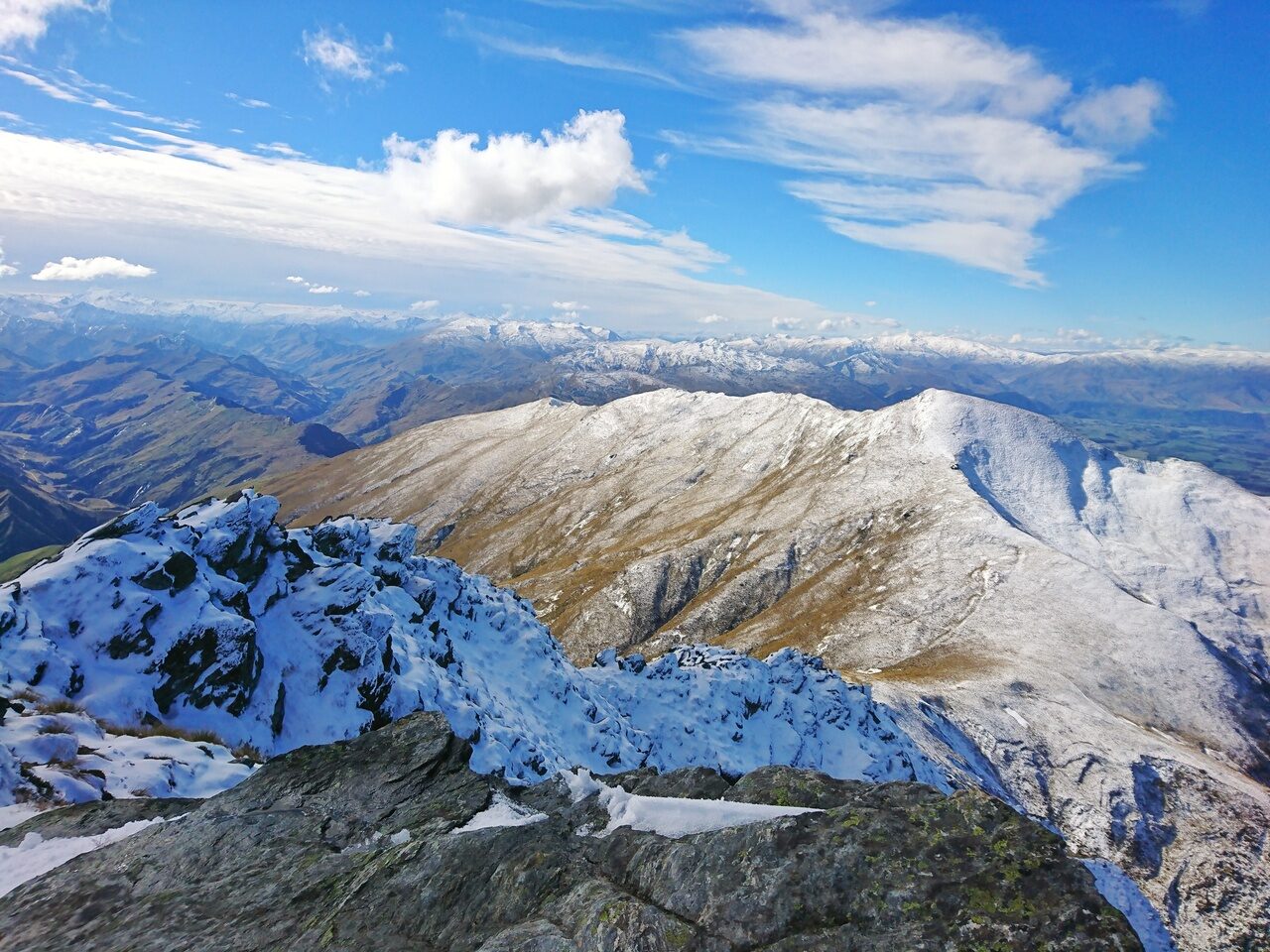
This is by far my most favorite hiking track in South Island, New Zealand. It is located in Queenstown alongside all the high adrenaline activities like Bungy jumping, the Nevis Swing, Skydiving etc. Do set aside a full day for this if you’re in for a majestic panoramic view of Queenstown, Lake Wakatipu and the Remarkables mountain ranges.
The Ben Lomond Track is a very demanding climb and takes you the entire day to complete. It’s a track you can do during summer and even winter, but the only thing I would recommend is to do it on a clear day. You wouldn’t want to miss that crazy view at the summit that made this my best track in New Zealand.
I completed this track in early April when the weather was still cool with a good amount of daylight time. Also, get ready for some icy tracks nearer to the peak and even tramping in knee-deep snow that I was not prepared for at all! It’s not easy but it’ll be a track you won’t forget if you do complete it~
2. Lake Matheson Walk
Fitness required: Suitable for all fitness
Gradient: Undulating
2.6 km loop, Walking and tramping (1 hr 30 min)
Highlights: Reflections of New Zealand’s tallest mountain, Aoraki/Mount Cook
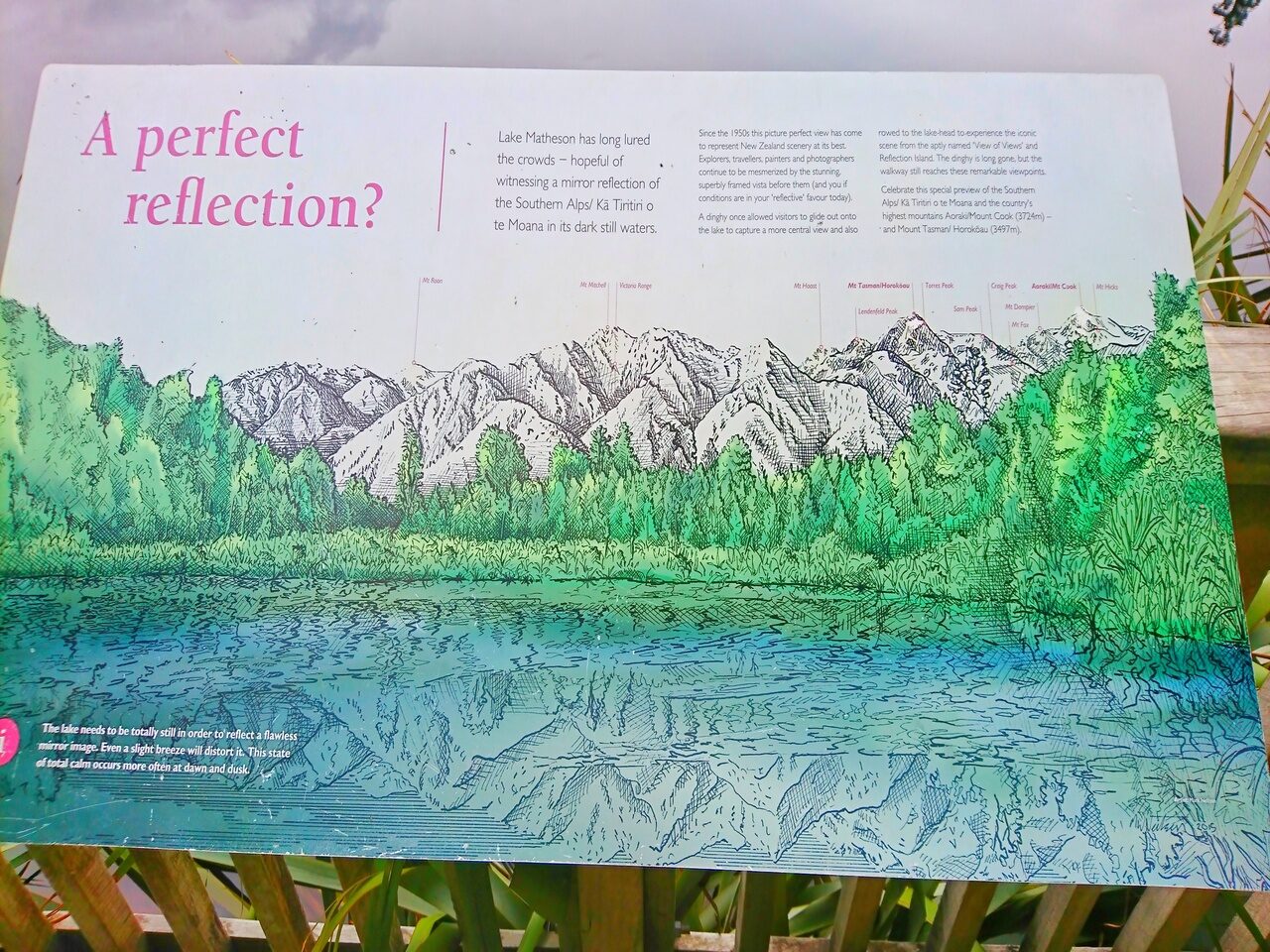


The Lake Matheson Walk is a very flat and relaxing walk suitable for anyone, even kids! It’s nestled in a lush ancient forest and is well-known for that perfect reflection of Aoraki/Mount Cook and Mount Tasman. The lake was really flat when I went and it was beautiful like a mirror as you can see from above!
Apparently the dark brown colour of the water caused by organic matter leached from the humus of the forest floor is responsible for that excellent reflecting property. The best time to do this would be sometime at dawn or dusk to enjoy the reflections in the lake.
3. Devil’s Punchbowl Waterfall
- Fitness required: Low to moderate
- Gradient: Gradual incline with steps
- 2 km return via same track, 1 hour return
- Highlight: Spectacular waterfall, Lush beech forest

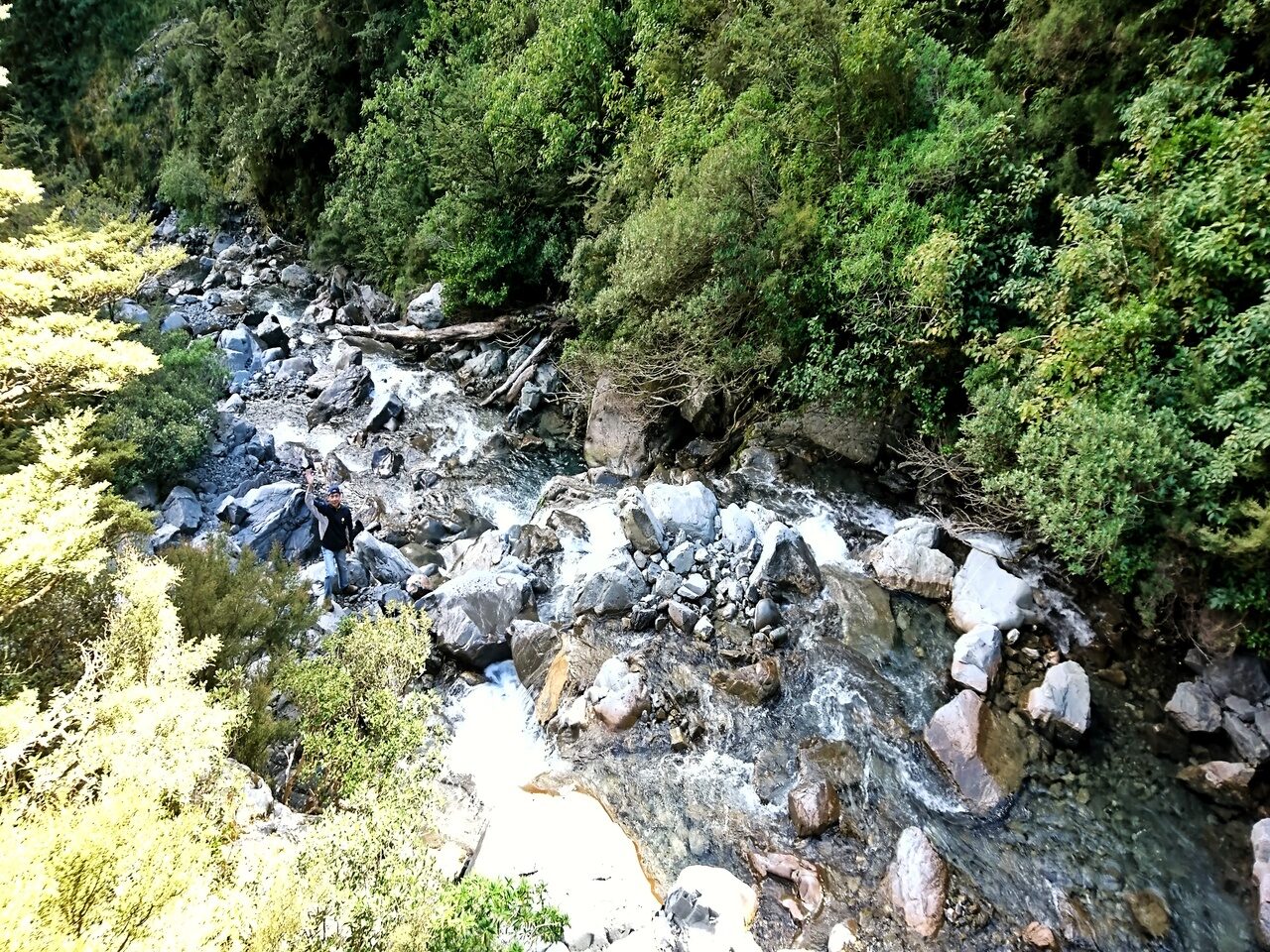


The Devil’s Punchbowl Waterfall track was a very enjoyable walk for me. It was a gradual ascend and consist of mostly steps. My favorite part was when I noticed how close we were to the powerful waterfall that measured 131m long upon completing the track. The sound of the waterfall and the fresh air at that altitude made me feel so accomplished!
I did this with my mum, aunt and uncle who were an average age of nearly 58. I thought this hike really suited them because of the short and yet slightly challenging journey. That ending view of the strong gushing fresh mountain water falling down easily made it into my list of New Zealand’s Top 5 waterfalls.
4. Hooker Valley Track
- Fitness required: Low
- Gradient: Flat
- 10 km return via same track, 3 hours
- Highlights: Views of Mueller Glacier, Hooker Lake and Mount Cook (New Zealand’s highest peak), Mount Cook buttercup (the world’s biggest buttercup)

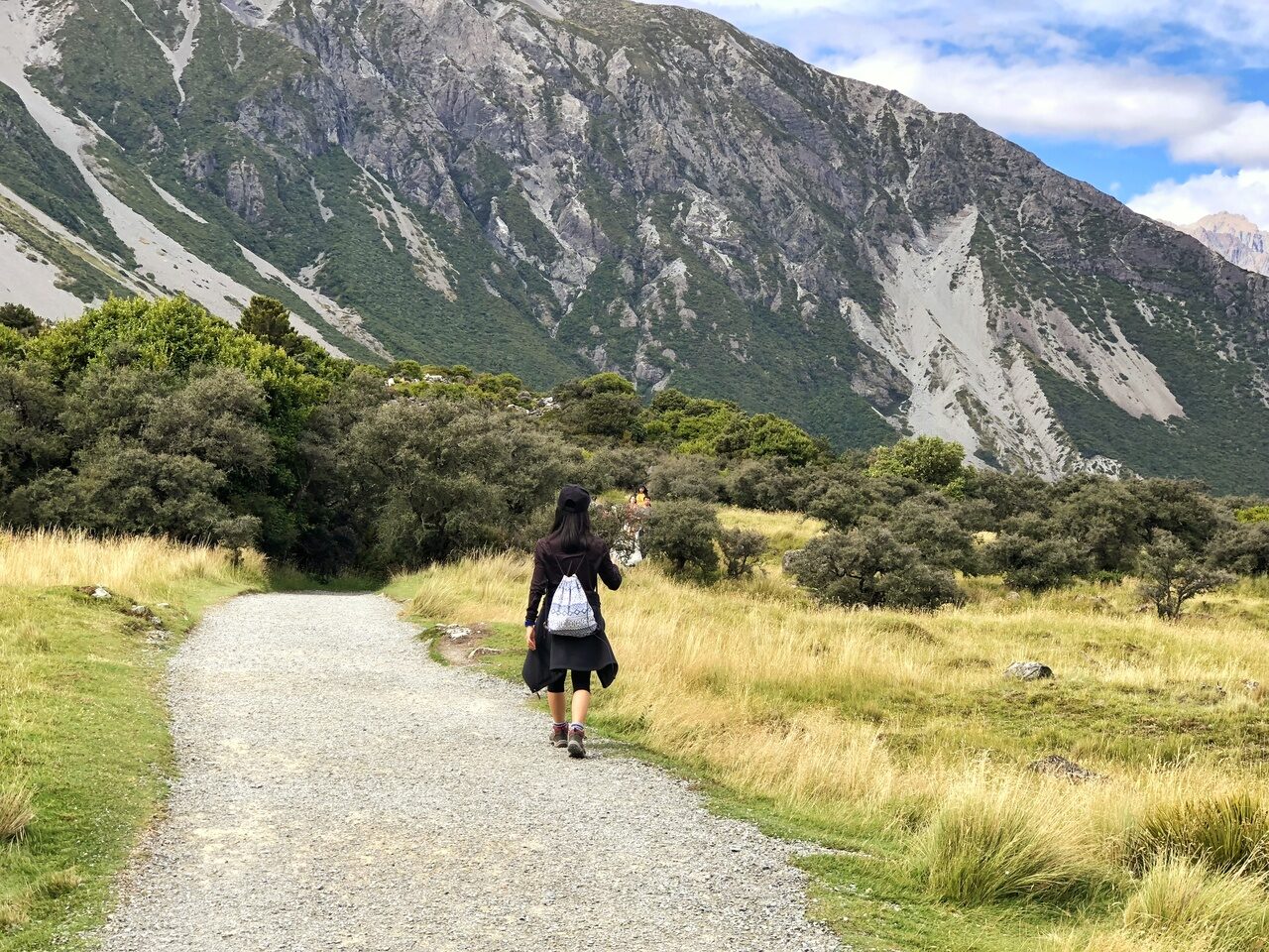


Hooker Valley Track is a fairly easy but fulfilling walk. On clear days, you get to enjoy the best Southern Alps landscapes and glaciers in the shadows of Mount Cook. You can choose to walk this track at dawn when you can view the sunrise over the Southern Alps. Otherwise, any other time of the day actually seems fine too if you’re not picky! The early birds however, do get the worms still as you are rewarded with the serenity of having most of the track to yourself.
I’ve been there twice, once in early March and another during late April. Both times, despite it being only nearly 1 month apart, offered spectacularly different views of the same place. The first time I went, the alpines and surrounding region was still a good mix of lush green and yellow. However, in April, the view changed dramatically to being white with neighbouring snow-capped moutains. The landscape was such a feast to the eyes!
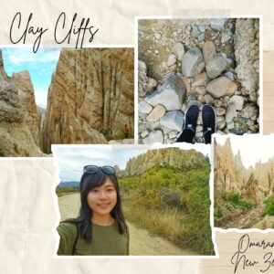
5. Omarama Clay Hills
- Fitness required: Low
- Gradient: Flat
- 400m return via same track
- Highlight: Clay Cliffs towering up to 30m tall

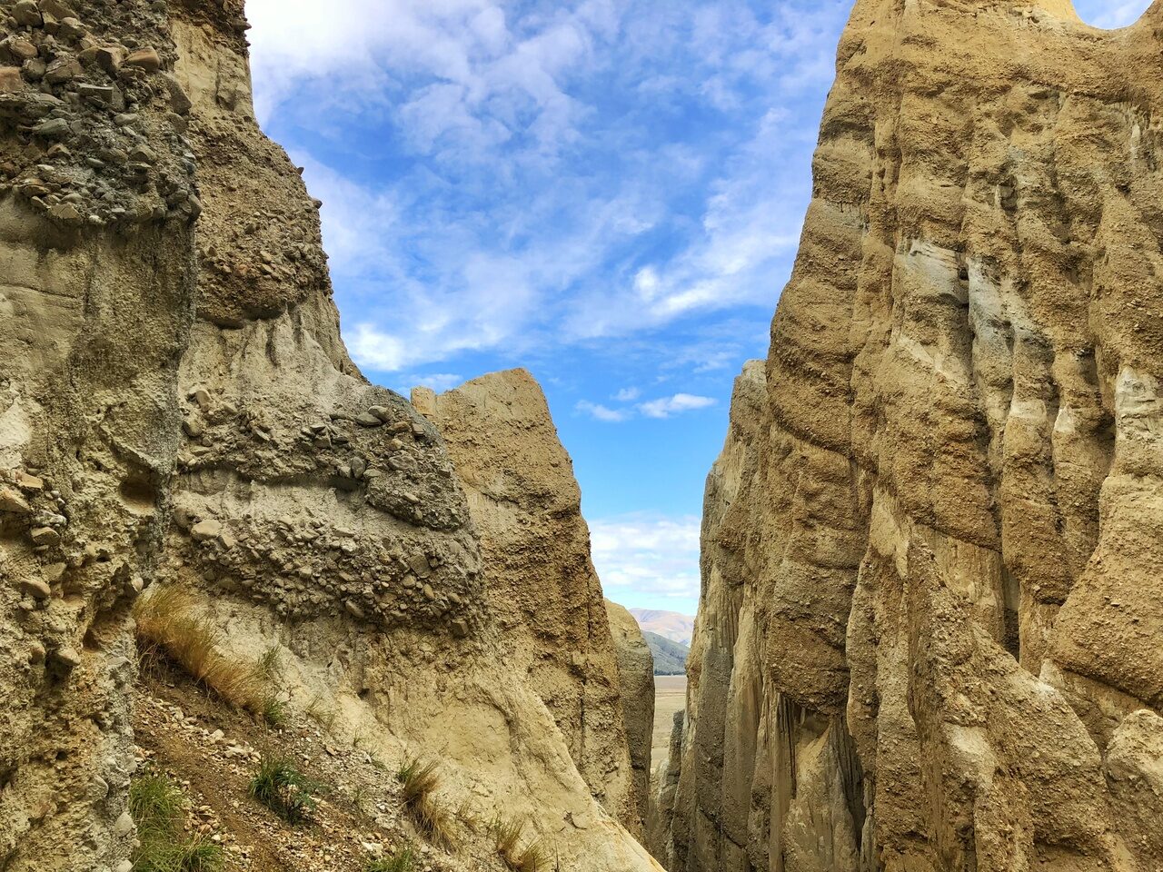
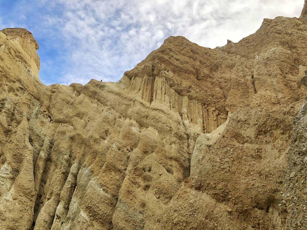
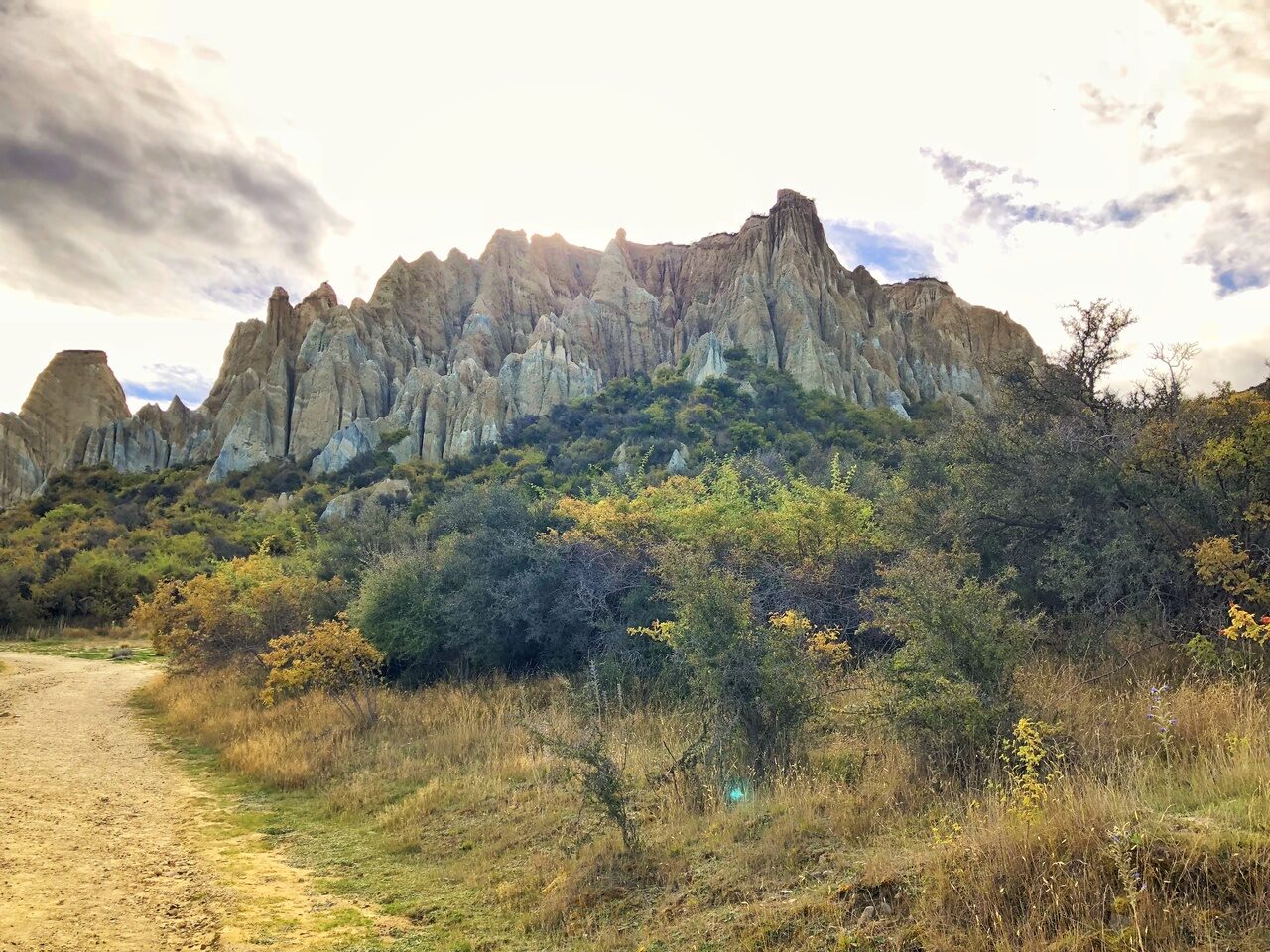
I would not consider this as a full hike but it’s definitely worth a stop. These unique landforms are made from layers of gravel and silt deposited by rivers from a few million years ago. You can follow a short track into the heart of the Cliffs before being free to explore whatever you want to then.
The Omarama Clay Cliffs are about 15 minutes away from the town of Omarama. It’s easy to miss the entrance to it through the gravel road from the main road if you’re travelling just a tad too fast. So do keep a look out for it as you drive!
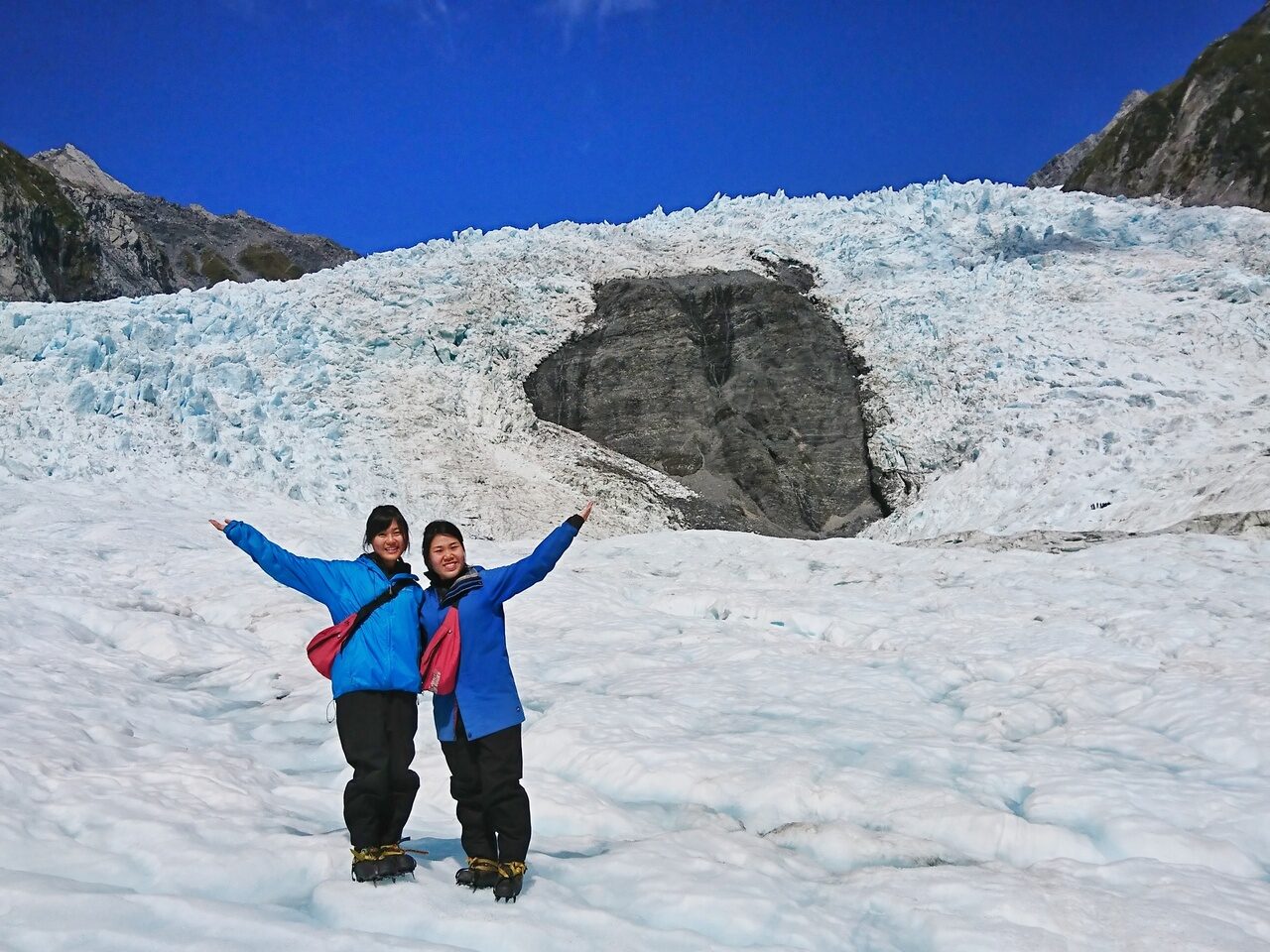
6. Glacier Heli-hikes


There are only two glacier heli-hikes down in the South Island of New Zealand, namely:
(a) Franz Josef Heli Hike
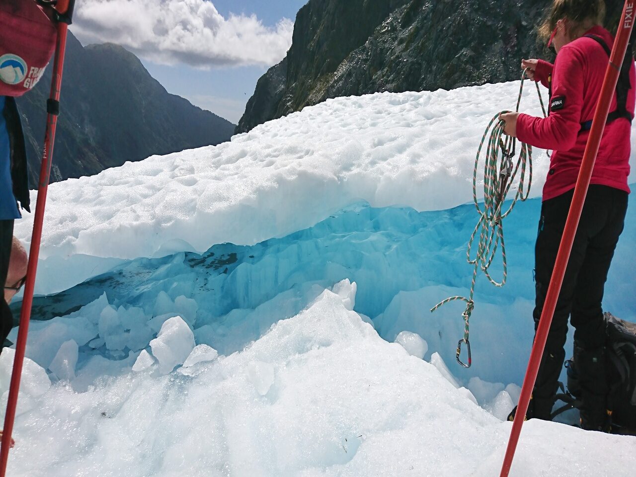
This is the one I went with, no particular reason though! It was a very unique hiking experience on the top of a glacier for me. I’m not sure how many countries you can do this in but this was a must-do for me in New Zealand. Basically, you take a helicopter directly to the top of the glacier and everything gets taken care of thereafter.
A skilled guide would bring you through various interesting spots on the glacier. I had the chance to crawl through blue ice tunnels and walk through ice caves. I’m sure everyone would have a different experience given how fast the features of glacier change. So, go ahead and add this to your bucket list for your own unique experience of the glacier!
(b) Fox Glacier Heli Hike
This is another popular option of a glacier heli-hike. They have options for various levels of hikes, for the novice to expert hikers. I like it that they have different packages to help you decide if you want to just have a typical icy hike on flat ground or pick an extreme 6-hours glacier hike. Definitely something I would love to try if I get a second chance to visit South Island again!
7. Hokitika Gorge
- Fitness required: Low
- Gradient: Flat
- 1.1km return via same track, 30 minutes
- Highlight: Blue-green waters of the Hokitika River

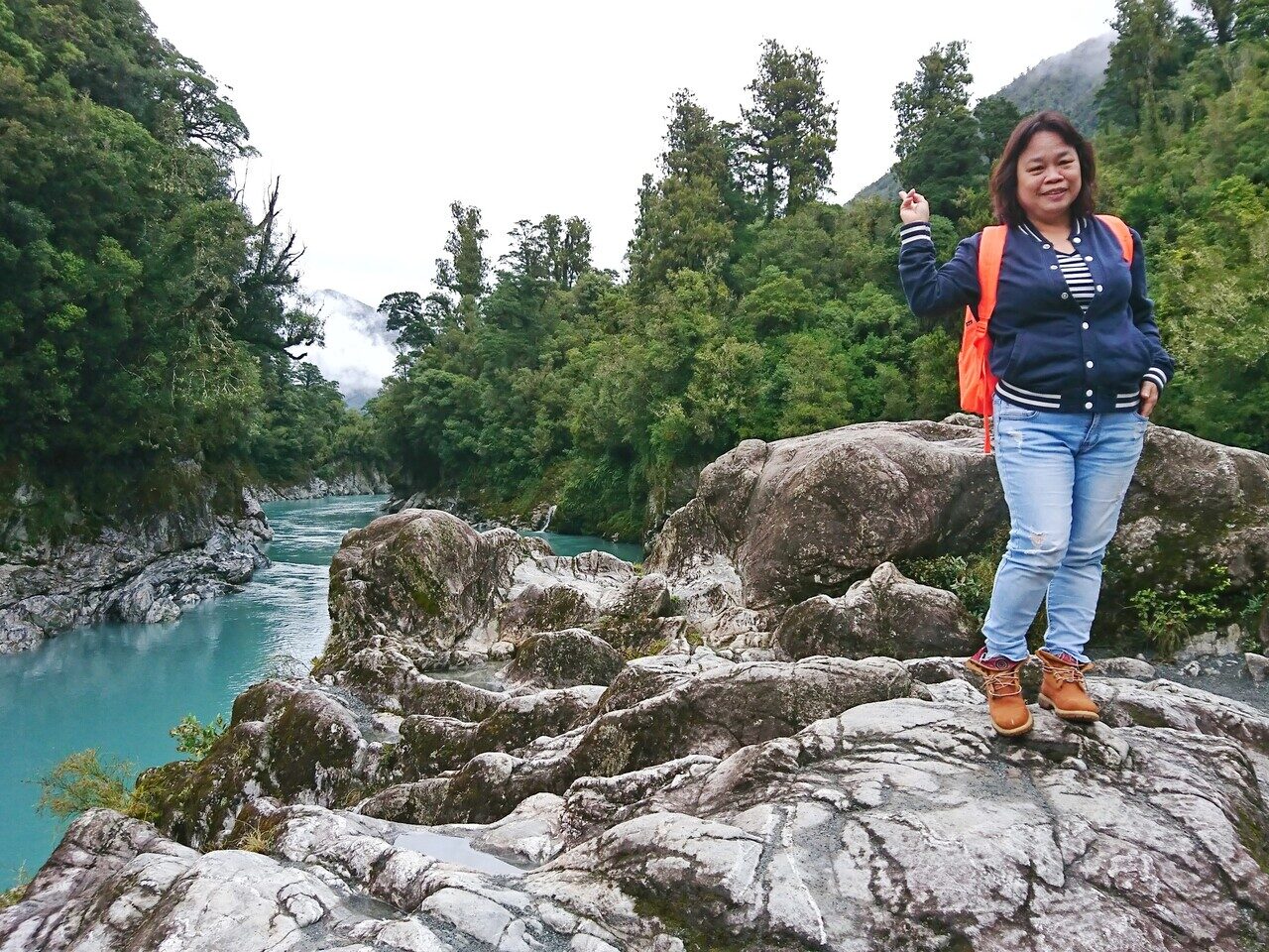
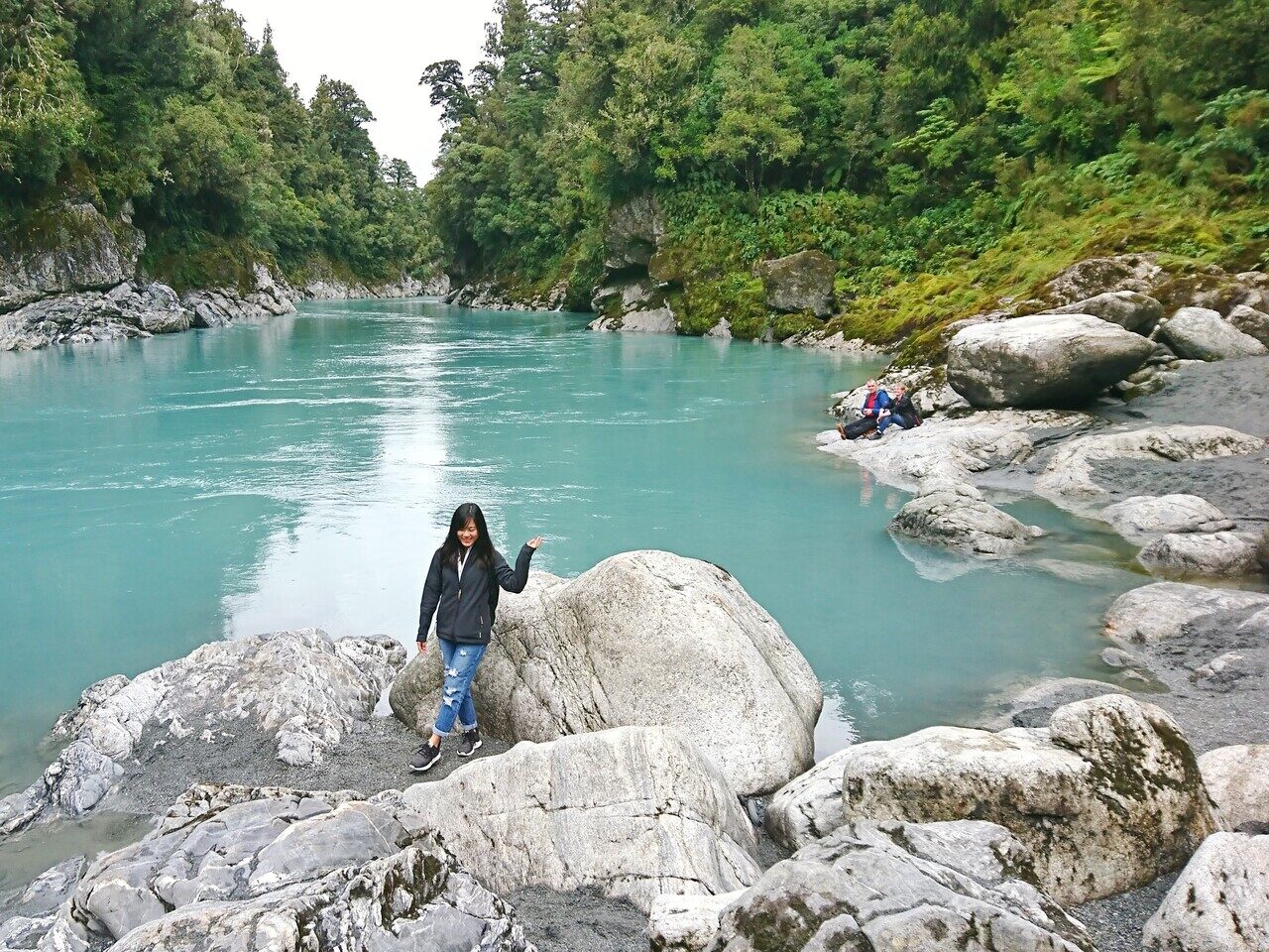
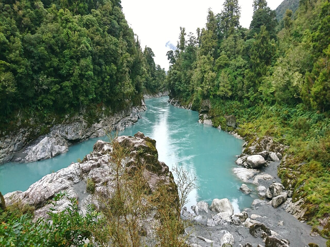
The Holitika Gorge walk is a short walk suitable for all ages. It goes across boardwalks, lush forests and a suspension bridge to get to the beautiful blue-green waters of the Hokitika river.
I recommend this trail because of how comfortable the entire journey is and rewarding at the end when we get close to the beautiful waters. The trail was also engaging throughout as you’ll see small waterfalls with the blue-green river glimpsed through the trees. It’s a great choice to put this on your itinerary if you are looking for a relaxed day in New Zealand!
Hiking Tracks in North Island
1. Tongariro Alpine Crossing
- Fitness required: High
- Gradient: Varies from flat ground to sharp ascending and descending tracks
- 19.4km one way, Walking and tramping: Nov-May: 7-8 hr | Jun-Oct: 9 hr
- Highlight: Mt Doom (LOTR Mordor), Red Crater, Blue Lakes

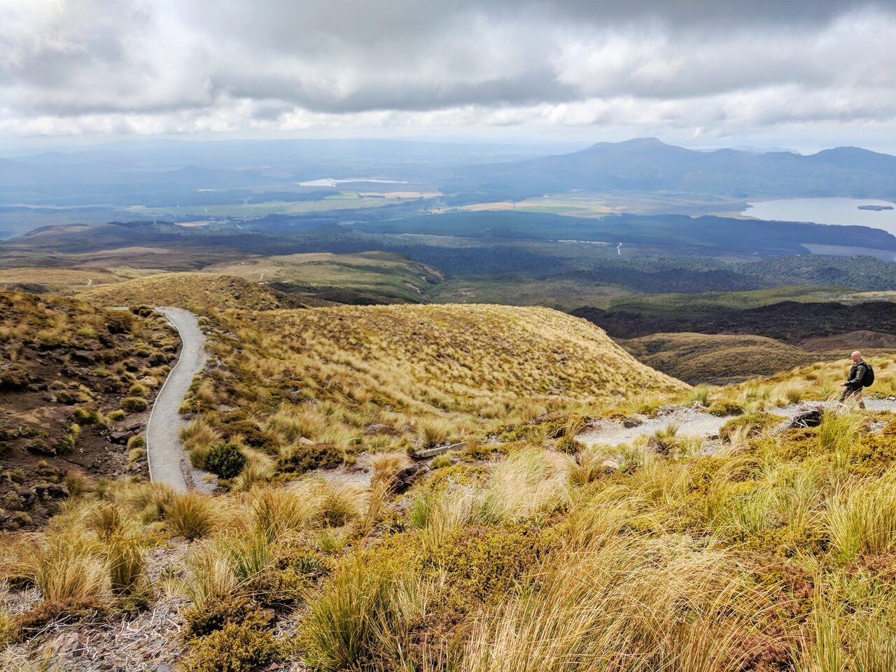
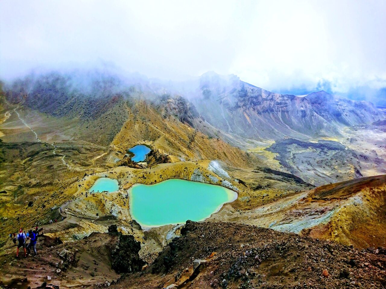

The Tongariro Alpine Crossing is one of the most popular day hikes in New Zealand. This credit has got to go to the three active volcanoes the track passes through and the unique blue lakes slightly after the summit.
This day track begins at a high altitude of 1,120 m, and for which the highest point on the crossing is at 1,886 m. You will then descend to a altitude of 760 m. In addition, views from both the summer and winter are both so captivating it’s definitely worth going there at least once each season! You can expect to see alpine vegetation throughout the track, smoking craters and historical lava flows, covered either in snow or mist depending on the time of the year you decide to go at!
Do have a read here for some tips I’ve gathered from my experience at Tongariro before you do yours!
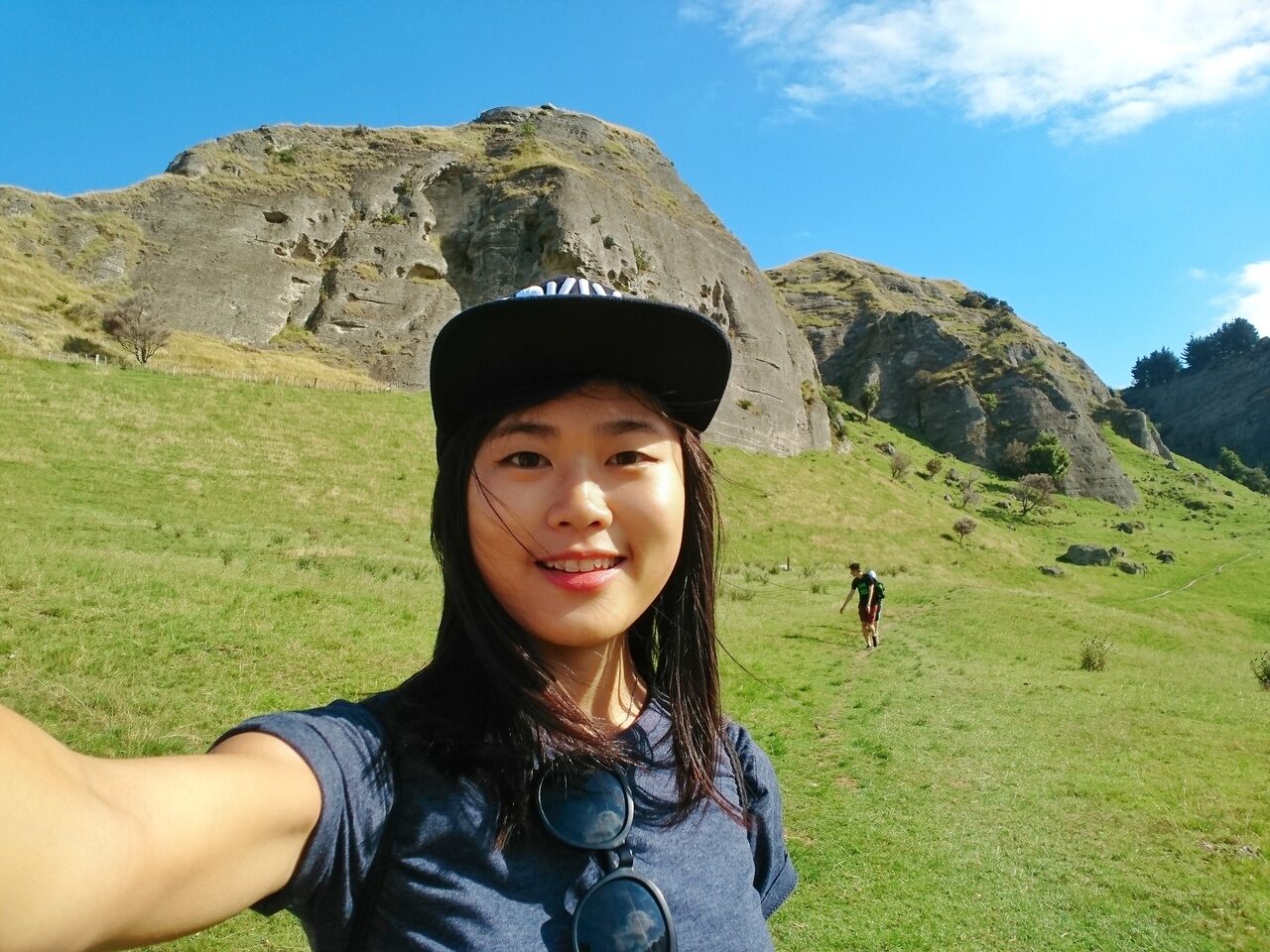
2. Te Mata Peak
- Fitness required: Low to Moderate
- Gradient: Flat to Steep Gradient
- 1.3 to 5.4km return via same track, 40 minutes to 2 hrs 15min return
- Highlight: The Giant’s Bite, Big Redwoods, The Summit, Saddle Lookout
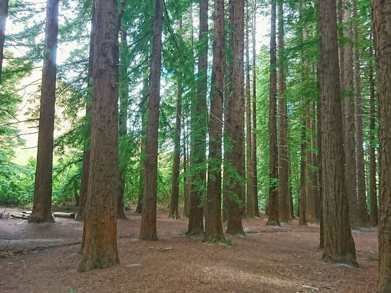
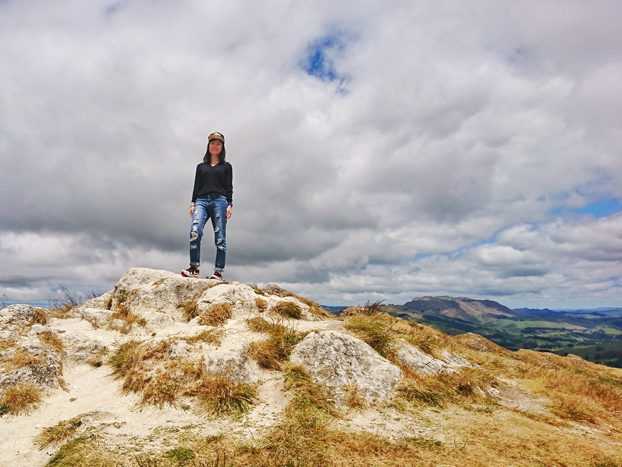

Also known as the Sleeping Giant, the Te Mata Peak is a local heritage site and cultural landmark in Hawke’s Bay. It stands at 399 metres and is a good spot for a wide range of recreational activities from walking, tracking, biking and picnics etc. This place is special to me because we were in the midst of the track when I got the message to tell me that I’m hired as a blueberry picker! How exciting!
Over here, you can pick from five different routes, namely the Green, Purple, Yellow, Blue, Red Track. This is in ascending order of difficulty and so, pick the one you’re comfortable with! I started off on the Red Track but I think we lost our way and ended up completing the track on the Yellow track. A great track to complete if you’re around the Hawke’s Bay area!
3. Shine Falls Track
- Fitness required: Low
- Gradient: Flat
- 4.4km return via same track, 1 hr 30min return
- Highlight: 58m tall Waterfall, highest in Hawke’s Bay


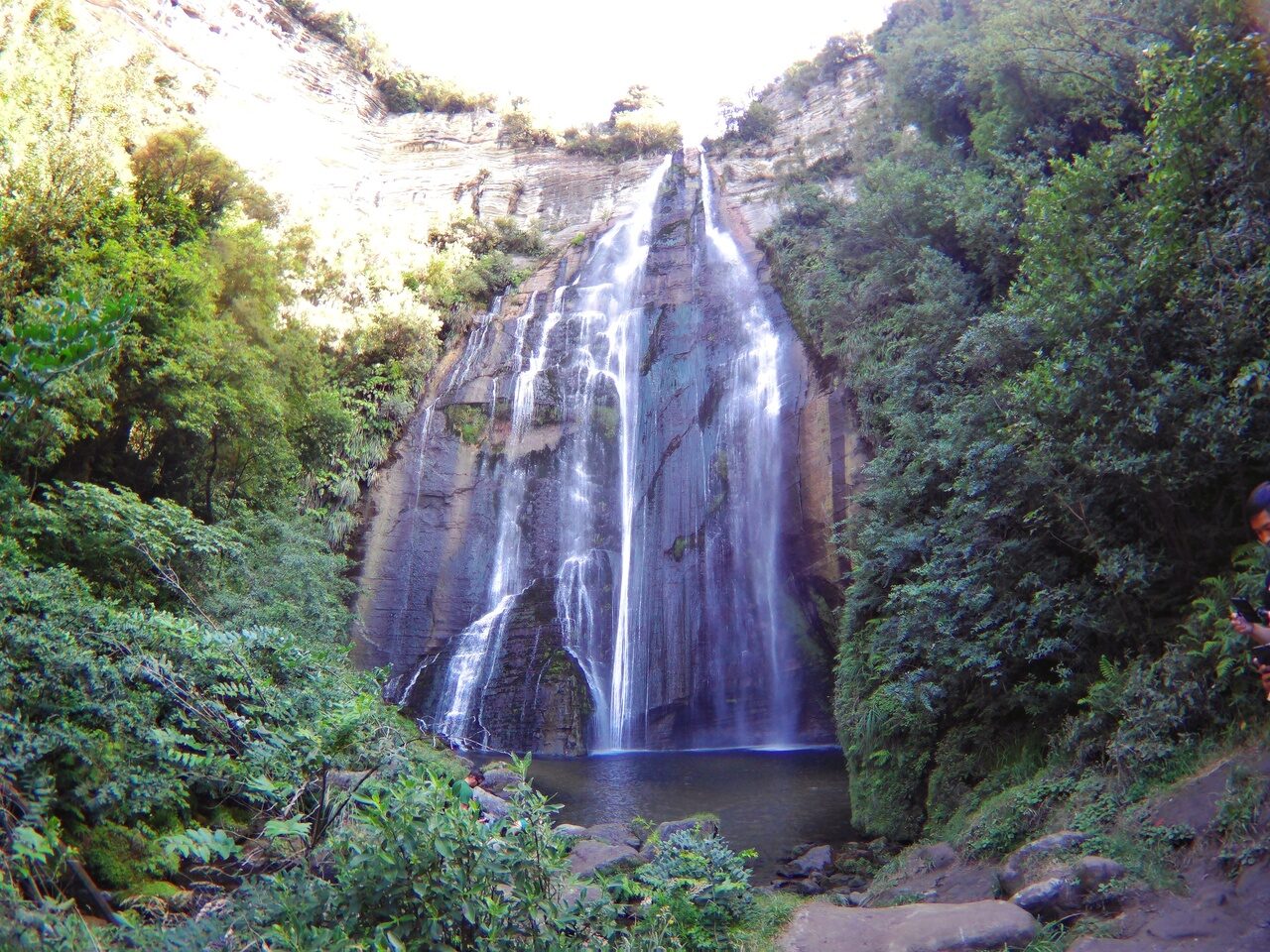
There are many track options to get to Shine Falls, the highest waterfall in Hawke’s Bay. The one I did is the Heays Access Road to Shine Falls Track if you’re looking for something short yet rewarding. This popular track wanders through farmland, limestone formations and into mixed lowland forest before emerging at the base of the stunning Shine Falls.
If you’re up for something more challenging, the other route I’d recommend is the Kamahi Loop Track to Shine Falls and Heays Access Road. This takes 5 hours one way at 8.3km in total. This track features an ancient mataī about 800 years old and birds such asthe rifleman and North Island robin. Instead of the base of the waterfall, you’ll emerge somewhere above Shine Falls. The track then descends steeply to reach the bottom of the spectacular Shine Falls before continuing to Heays Access Road.
The End!
With that, I hope you enjoyed reading this and am ready to go on your next hike in New Zealand! All the best 🙂